
Flash Floods and Landslides in KP: Climate crisis
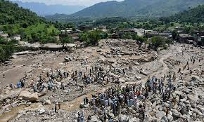
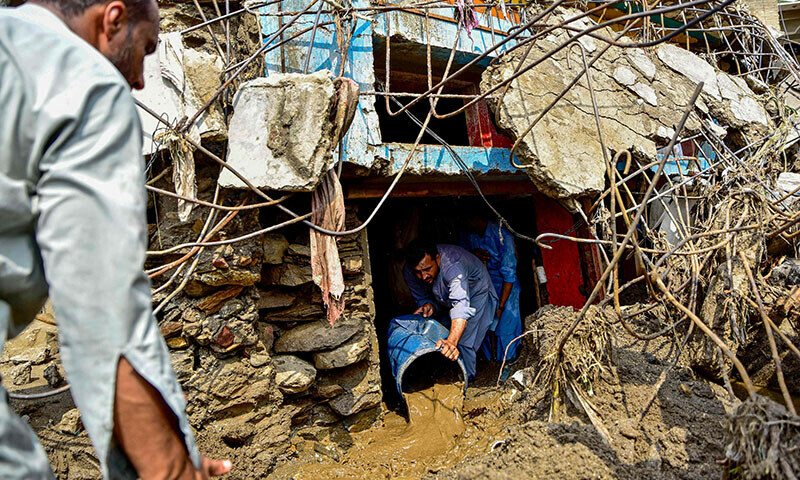
Flash floods and landslides in Khyber Pakhtunkhwa (KP), Pakistan, have caused devastating impacts, exacerbated by the ongoing climate crisis. Since June 2025, heavy monsoon rains, intensified by climate change, have triggered widespread destruction in KP, particularly in districts like Buner, Swat, and Shangla. Over 425 deaths have been reported in KP alone, with Buner recording at least 274 fatalities and 209 missing persons. Entire villages have been swept away, homes destroyed, and infrastructure, including roads and schools, severely damaged. For instance, 61 government schools were completely destroyed, and 414 others damaged across affected districts.
Climate Crisis Contribution
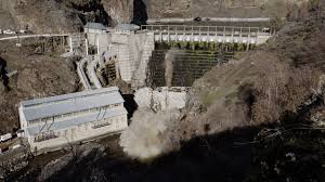
Experts link the increasing frequency and intensity of these events to climate change. Monsoon rains in 2025 were 50-60% more intense than the previous year, driven by warmer temperatures and rising sea surface temperatures in the Indian Ocean, which amplify precipitation. Glacial melting in the Himalaya–Hindu Kush region, including major glaciers like Baltoro and Siachen, has led to glacial lake outburst floods (GLOFs), further compounding flood risks. Deforestation, particularly the loss of deodar forests due to illegal logging, has eroded natural flood barriers, making landscapes more vulnerable to landslides and flash floods.
Local Factors
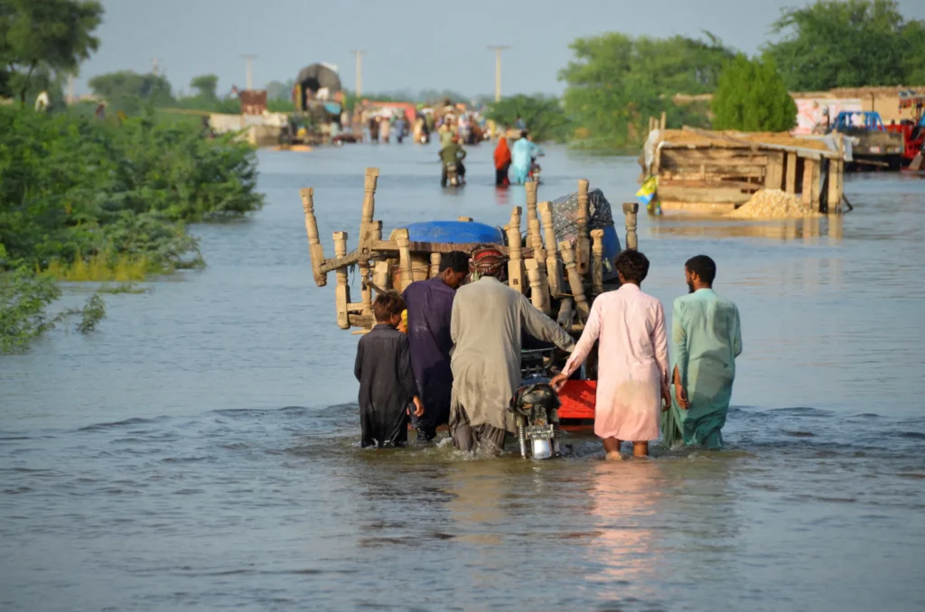
Unplanned urban development, construction on riverbanks and floodplains, and inadequate infrastructure, such as clogged stormwater drains, have worsened the impacts. In KP, encroachments along rivers like the Swat have amplified flood damage. The lack of effective early warning systems and disaster management has been criticized, with local communities expressing frustration over delayed government responses and insufficient rescue equipment.
Response and Challenges
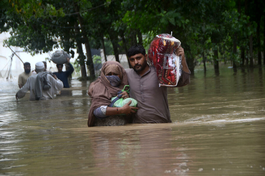
Rescue operations, involving Pakistan’s military, drones, and boats, have saved over 25,000 people, but difficult terrain and ongoing rainfall hinder efforts. UNICEF has dispatched medicines and highlighted the severe toll on children, with 171 child deaths and 256 injuries reported. The National Disaster Management Authority (NDMA) has distributed relief items, but remote areas face shortages of food, clean water, and medical care.
Solutions and Outlook
Experts emphasize the need for climate-resilient infrastructure, stronger early warning systems, and reforestation to restore natural buffers. Pakistan’s National Adaptation Plan aims to address these issues, but implementation remains challenging amid political and economic constraints. With forecasts predicting heavy rains into September 2025, authorities have declared disaster zones in several KP districts and urged tourists to avoid northern areas like Swat and Hunza
While climate change is a significant driver, local factors like deforestation and poor urban planning play a critical role. Pakistan, contributing less than 1% to global emissions, faces disproportionate impacts, underscoring the need for international support through mechanisms like the Loss and Damage Fund established at COP27.
BUNER Flood
- buner spans from the plains of Totalai in the south (1,200 ft) to the heights of Dosara Peak near Elum Ghar in the north (9,550 ft)
- The landscape is characterized by pine-covered hills and a network of springs and streams, like Barandu, Chamla, and Budal, vital for irrigation and drinking water.
- The region is environmentally significant but faces challenges such as deforestation, pollution from marble factories and tobacco barns, and contaminated water sources
- Buner is a district in Khyber Pakhtunkhwa, Pakistan, characterized by hilly terrain and a rural environment. It lies between 34-9 and 34-43 N latitude and 72-10 and 72-47 E longitude. The district is bordered by Swat, Malakand, Mardan, and the Indus River. The area features a variety of elevations, with the Dosara peak reaching 9,550 ft and the Totalai area in the south at 1200 ft. Three main rivers, Barandu, Chamla, and Budal, flow through the district.
- Hilly Landscape:
.In mid-August 2025, KP endured catastrophic flash floods and cloudbursts, particularly in central and northern districts like buner-, Swat, Bajaur, Mansehra, Battagram, Shangla, Lower Dir, and.
buner District, especially the Pir Baba area, was the hardest hit, with around 184 deaths.
Other affected districts include Shangla, Mansehra, Swat, Bajaur, Battagram, Lower Dir, and Abbottabad Outlook
The death toll across KP has surpassed 300, with PDMA and NDMA reporting between 307 to 321 confirmed fatalities
A Mi-17 rescue helicopter crashed during operations under adverse weather, claiming the lives of all five crew members Infrastructure across regions was severely impacted—with washed-away roads, bridges, buildings, power lines, and blocked routes due to landslides Reuters
Rescue operations are underway with help from civilian rescue teams (Rescue 1122), military units, and federal agencies (NDMA). Efforts include evacuations via air and ground, setting up medical camps, distributing food and shelter, and repairing infrastructure.
The Pakistan Army has played a pivotal role: dispatching units, contributing rations, executing bridge repairs, donating a day’s salary, and deploying rescue dogs and helicopters
Prime Minister Shehbaz Sharif convened an emergency meeting with NDMA, promising full federal support including dispatching essential supplies, enhancing coordination and evacuation procedures.
Emergency funding has been allocated: ~Rs 500 million in total, with specific disbursements such as Rs 150 million for Buner and Rs 100 million each for Bajaur, Battagram, and Mansehra; Swat receiving Rs 50 million Business Recorder.